St John's Top 5: Cartouches
This month we’re taking a look at some examples of fine map cartouches from the College's estates.
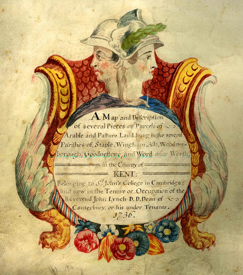
A map and description of several pieces or parcels of arable and pasture land lying in the several parishes of Staple, Wingham, Ash, Woodnesborough, Goodnestone, and Word alias Worth, in the County of Kent: belonging to St John's College in Cambridge; and now in the tenure or occupation of the Reverand John Lynch D.D. Dean of Canterbury, or under his tenants. 1736 (MPS1-1)

A map of several lands and tenements lying in the parish of Ospringe in the County of Kent part of the estate of the College of St John the Evangelist in Cambridge; by the order of the Rev'd John Bowtell D.D. (John Quested, tenant). 1738 (MPS188-1)
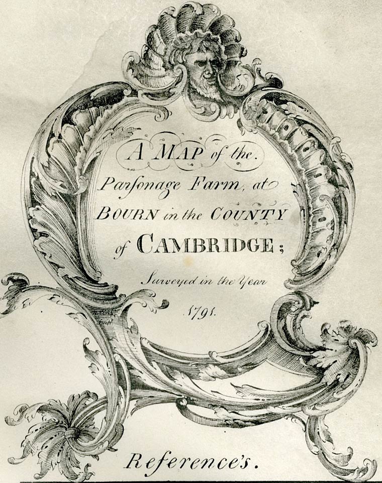
A map of the Parsonage Farm, at Bourn in the County of Cambridge; surveyed in the year 1791. (MPS6-1)
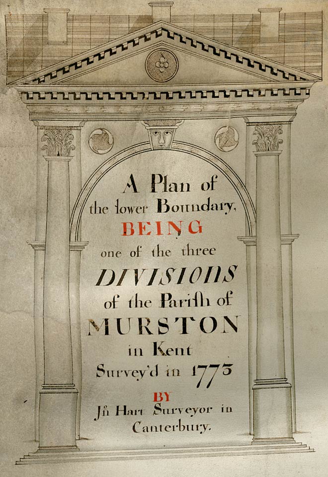
A plan of the lower boundary being one of the three divisions of the parish of Murston in Kent. Servey'd in 1775 by John Hart Surveyor in Canterbury. (MPS691-1)
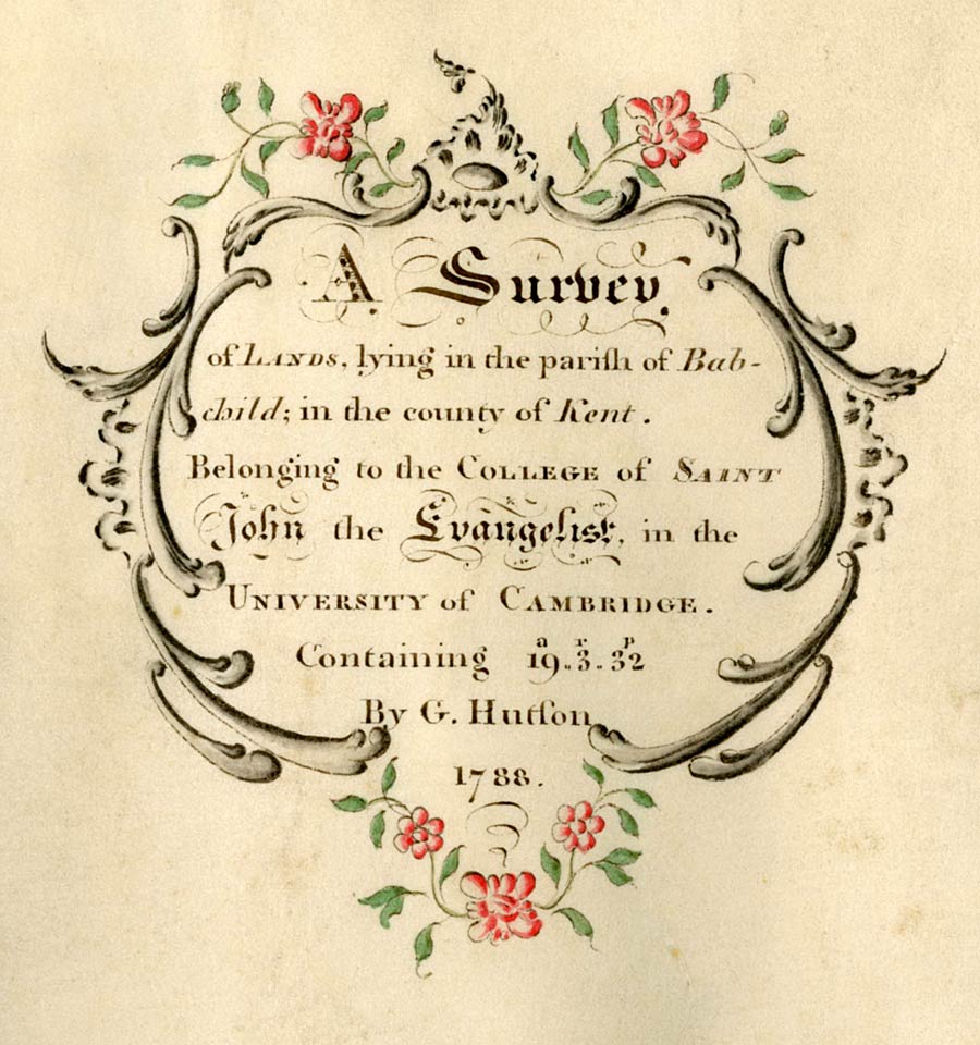
A survey of lands, lying in the parish of Babchild; in the county of Kent. Belonging to the College of Saint John the Evangelist in the University of Cambridge containing 19 a[cres]. 3 r[ods]. 32 p[erches] by G Hutson 1788. (MPS2-1)