Pocket map of Brighton and Sussex Coast
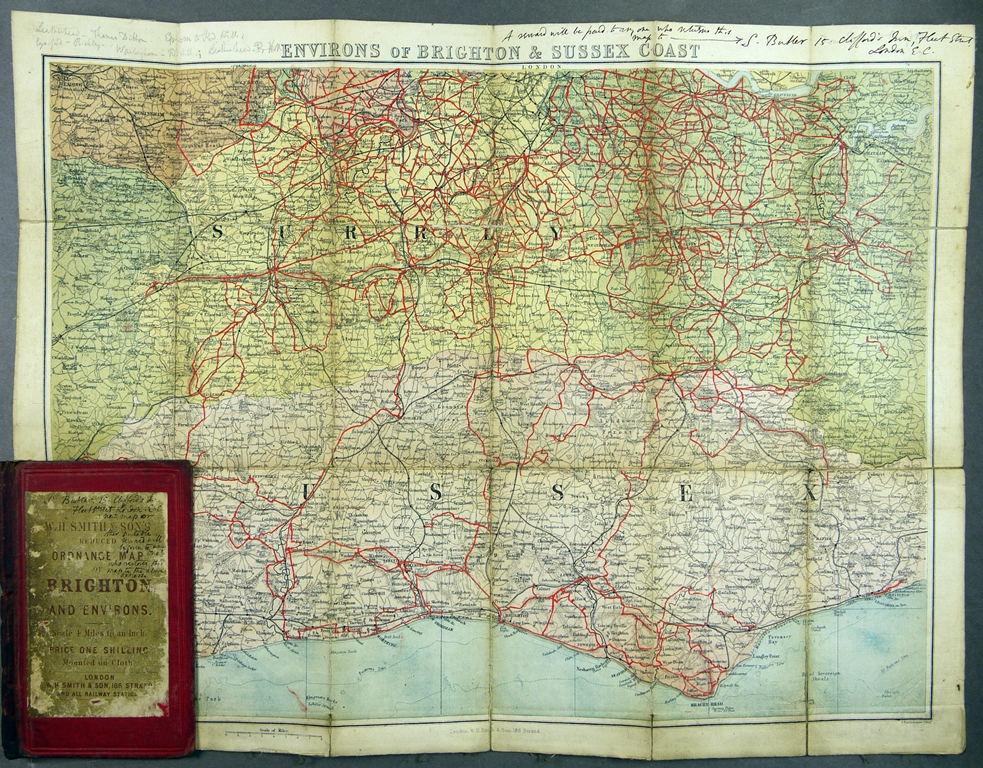
Butler was a fan of the railways, using them as a starting point for extended walks in the countryside and along the coastal paths of South East England. A number of Ordnance maps, used by Butler to plan and record his journeys, are preserved in the collection. Many are marked with red ink lines showing the impressive distances Butler covered (many hundreds of miles on this map alone), and notes in pencil of some of the stations he passed through.