James Clark Ross
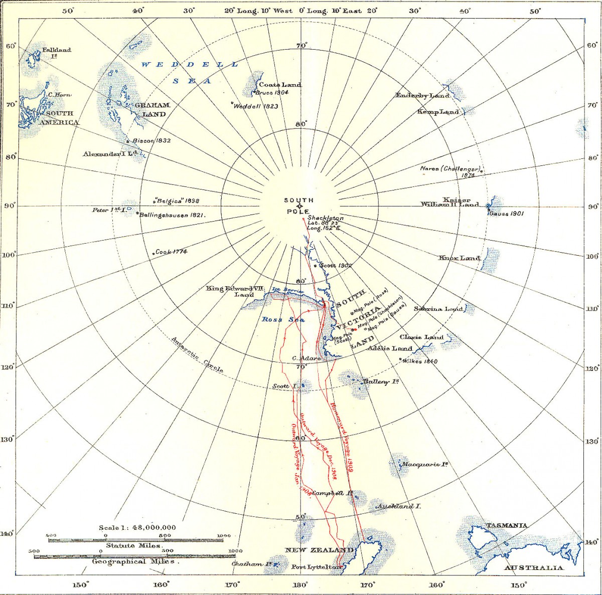
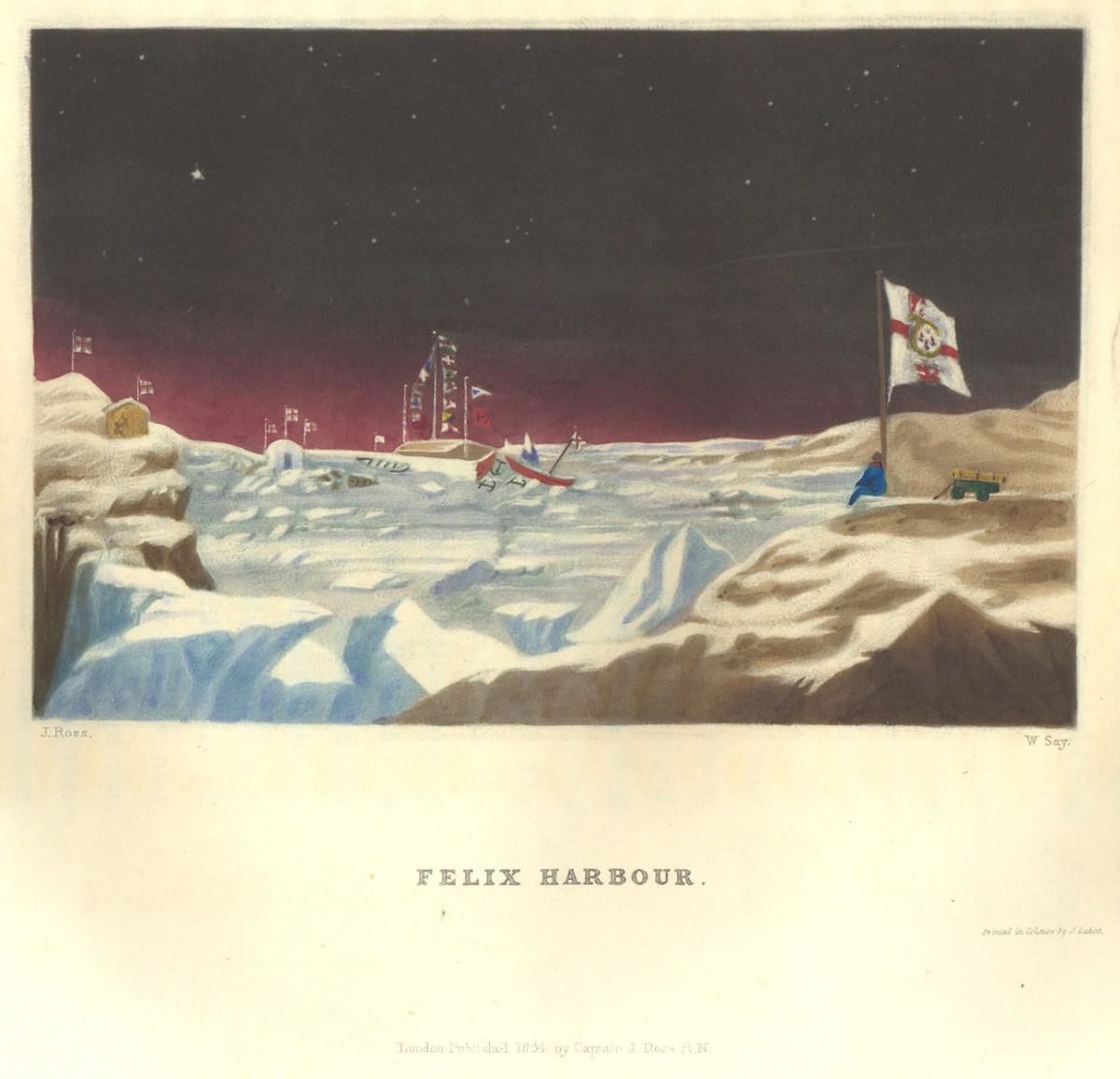
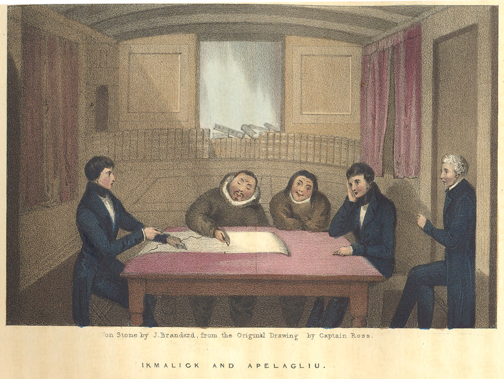
The Ross Sea (named after James Clark Ross) is marked on this 1909 map of Shackleton's Antarctic expedition towards the South Pole. The Ross Ice Shelf is marked 'ice barrier'. The other pictures on this page are from John Ross's book about the Rosses' Arctic expedition of 1829-1833. The top image shows their boat, the Victory stuck in the ice at Felix Harbour. The expedition spent a total of four winters in the Arctic. They survived by eating the same diet as the Inuits. The Inuits also helped the Rosses make maps of their surroundings. The picture below shows this. Click on the pictures to see more. | James Clark Ross joined the British Navy when he was twelve. He sailed on several voyages in search of a Northwest Passage. On his uncle John Ross’ expedition of 1829-1833 he discovered the North Magnetic Pole.
Ross also explored the Antarctic from 1839-43. He took two ships, the Erebus and the Terror, through pack-ice and past live volcanoes towards the South Pole. He turned back when he reached a great wall of ice. This is now known as the Ross Ice Shelf. Ross helped search for John Franklin when he went missing during his search for the Northwest Passage in 1847. The search helped map the area. It established that there is no easy Northwest Passage.
|