The Northwest Passage
By the late sixteenth century, Spain and Portugal controlled the two best routes from Europe to the riches of Asia. Other European countries hoped to find another way from the Atlantic to the Pacific by sailing through the Arctic, north of America. British explorers Martin Frobisher (in the 1570s), John Davis (in the 1580s) and Henry Hudson (in 1610) all looked for this Northwest Passage, but failed to find it.
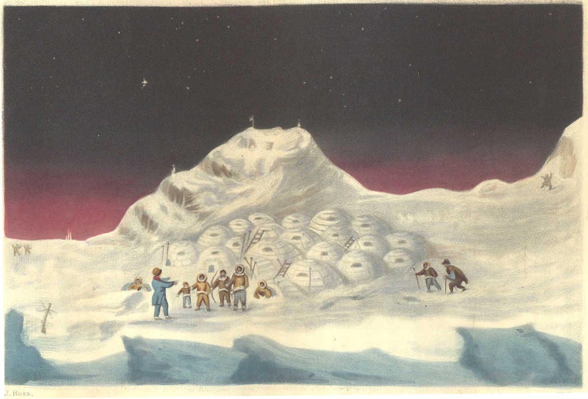
In the nineteenth century the British tried again. Explorers including John Ross, James Clark Ross and John Franklin continued the search. The picture of igloos (below) is from John Ross' account of his second expedition to find the Northwest passage. Click on the picture to see more.
These explorers discovered that there is no easy Northwest Passage. The Atlantic and Pacific oceans are connected but only by dangerous corridors that twist and turn through the ice and rock in the Arctic Ocean. The Norwegian explorer, Roald Amundsen successfully navigated these passages in 1903-06, sailing from the Atlantic to the Pacific, but they were too dangerous to be used as a shipping route.
In the end a short cut through the narrowest part of the Americas had to be built. This was the Panama Canal in Central America. It opened in 1914.
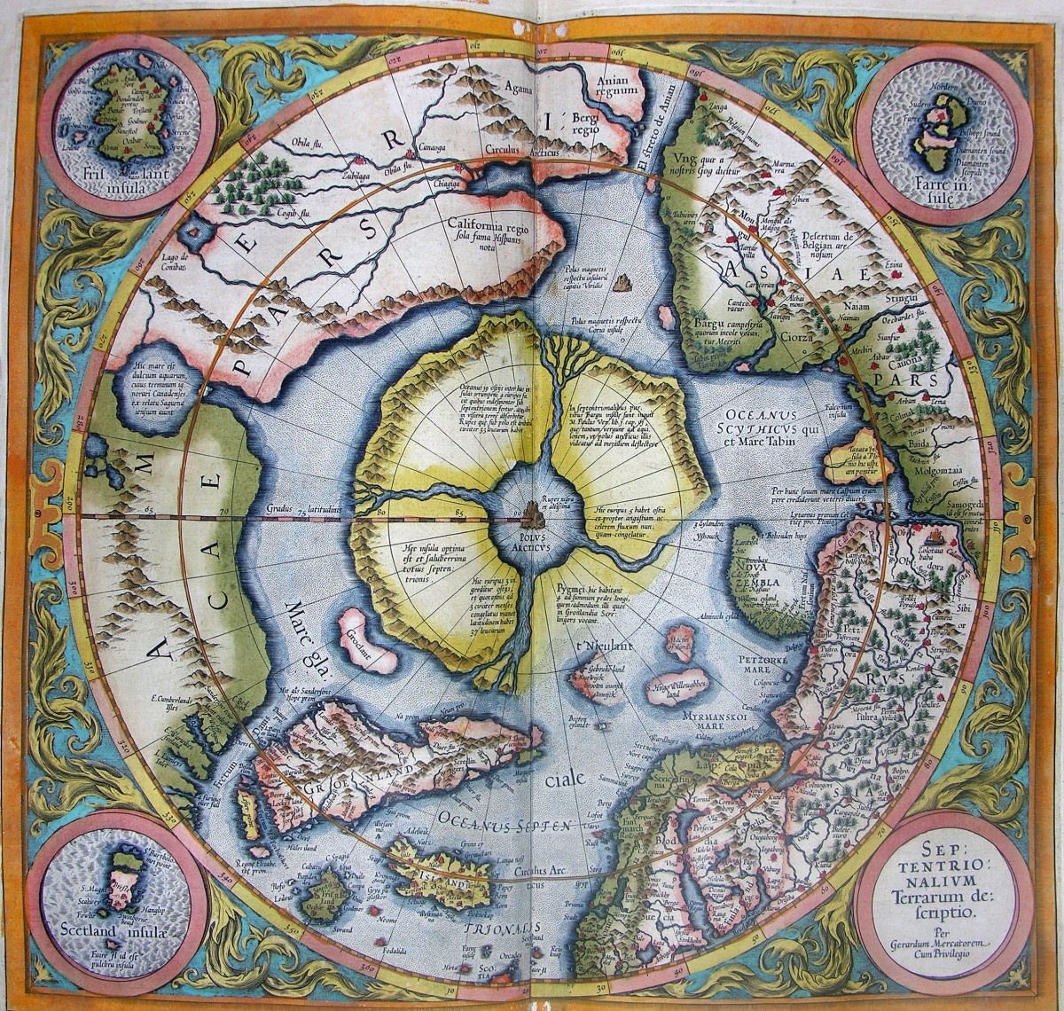
Above is Gerard Mercator’s map of the Arctic, from the 1613 edition of his atlas. It shows the Northwest Passage as sixteenth-century explorers thought it was. Can you trace the Northwest Passage from the passage to the Atlantic, round the top of the North American continent, to the passage to the Pacific?
Mercator’s map also shows an Arctic continent with a black rock of magnetic iron at the North Pole. Later explorers found that there is no land here, just a frozen ocean. Click on the map to see more.